
Petra is an archaeological site in Jordan, located about 250 km south of the capital Amman, in a basin between the mountains east of the Wadi Araba, the large valley extending from the Dead Sea to the Red Sea Gulf of Aqaba.
Its Semitic name was Reqem or Raqmu (“the Colorful”), also attested in the Qumran manuscripts.
It was allegedly founded as a city of the Edomites and then became the capital of the Nabataeans, a highly evolved people of warriors and traders, whose branched merchant network connected the south of the Arabian Peninsula with the Mediterranean.
Towards the eighth century, Petra was abandoned following the decline of trade and natural disasters and, although the ancient caves have hosted Bedouin families until recent years, it was in a certain sense forgotten until the modern era.
The archaeological complex was revealed to the Western world by the Swiss orientalist Burckhardt in 1812.
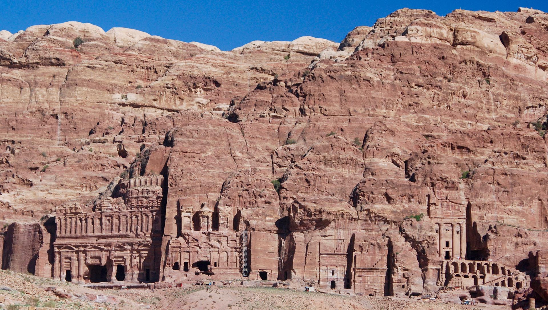
The numerous facades carved into the rock, referable for the most part to tombs, make it a unique monument, which was declared a World Heritage Site by UNESCO on December 6, 1985.
Since 1993, the surrounding area has also been a national archaeological park.
Furthermore, in 2007, Petra was declared one of the so-called seven wonders of the modern world.
Its name origins from the Greek word πέτρα, meaning “rock”.
The incredible structures observable at Petra are in fact entirely carved out of the rock with impressive craftsmanship.
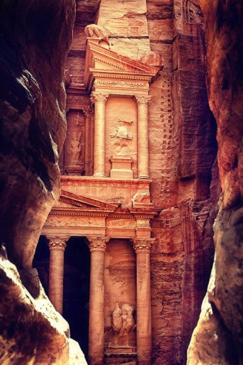
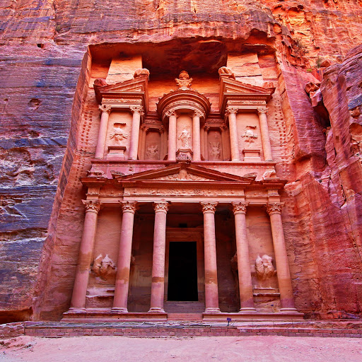
The city is accessible through a 1.2 kilometer-long (0.75 mi) gorge called the Siq, which leads directly to the Khazneh, or the “Treasury”, the most famous structure of Petra, also called the ‘Rose City’ because of the color of the stone from which it is carved.
Made strategically important by the Nabateans, a Bedouin tribe that settled at Petra during the 4th century BCE and made it their capital, the area was inhabited as early as 7000 BCE.
There are reasons to believe that the Nabateans found a previously established settlement, as even though it is generally accepted that they were skillful in stone carving and agriculture, there is actually no evidence of their presence previous to the 2nd century BCE, the period in which Petra was already their main center and capital.
According to tradition, in ca. 1200 BCE, the area was populated by the Edomites, an ancient civilization renowned for its stone carving abilities. They were the Biblical descendants of Esaù, and the area was known as Edom (“red”, because Esaù was red-haired).
According to the Quran, Islamic tradition maintains that the tribe “took for themselves palaces from its plains and carved homes from the mountains”.
Its Semitic name Reqem or Raqmu, meaning “the Colorful” (The name ‘Reqem’ (rqm) was inscribed in the rock wall of the Wadi Musa opposite the entrance to the Siq), since the various buildings were all beautifully colored like described in the Qumran scrolls.
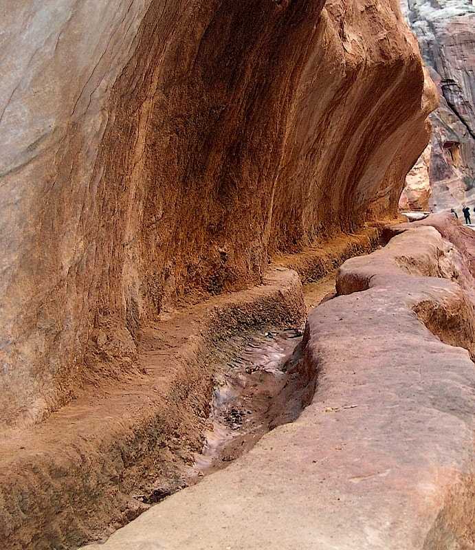
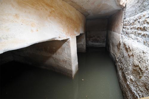
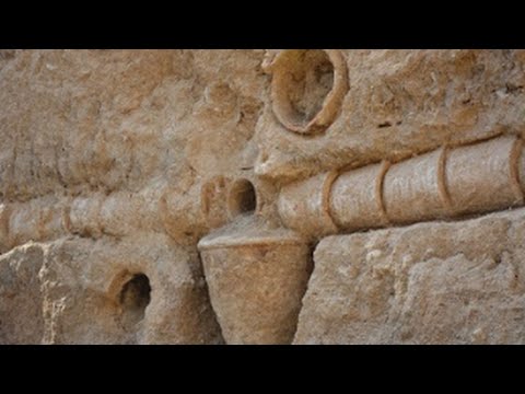
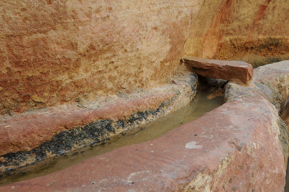
What may seem raw carved structures in the middle of the desert, were in fact part of an astonishing settlement that comprehended a large swimming pool and an elaborate garden, an island pavilion, and a complex hydraulic system.
Whoever originally built the city was, in fact, a civilization not only skilled in stone carving and agriculture, but also in water harvesting and engineering.
Excavations have demonstrated that the Nabataeans, or its previous inhabitants, were able to control the water supply that led to the rise of the desert city, creating an artificial oasis.
The area is visited by flash floods, but archaeological evidence shows that the Nabataeans controlled these floods by the use of dams, cisterns, and water conduits.
An Ancient Pyramid
In 2016, archaeologists using satellite imagery and drones discovered a very large, previously unknown monumental structure whose beginnings were tentatively dated to about 150 BCE without actual evidence.
It is located outside the city’s main area, at the foot of Jabal an-Nmayr, and about 0.5 mi (0.80 km) south of the city center, but is facing east, not towards the city, and has no visible relationship to it.
The structure consists of a huge, 184 by 161 ft (56 by 49 m) platform, with a monumental staircase along its eastern side.
The large platform enclosed a slightly smaller one, topped with a comparatively small building, 28 by 28 ft (8.5 by 8.5 m), which was facing east toward the staircase.
The structure, second in size only to the Monastery complex, probably had a ceremonial function of which not even a speculative explanation has yet been offered by the researchers.
It might have been in fact a kind of pyramid in the Tiwanaku’s Akapana style of the much nearer ziggurat.
This structure might actually be much older than Petra itself and could indicate that later civilizations settled in an ancient important point of interest, as in the case of many other archaeological sites throughout the globe.
There is still much to learn about the Rose city as, despite almost 100 years of excavation, only one percent of it has been investigated.