
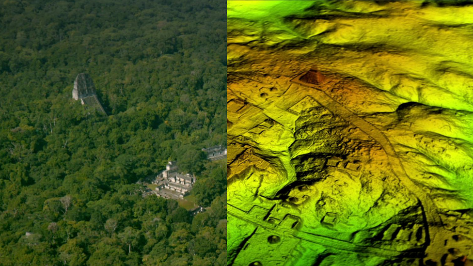
Despite being a small country of just 100.000 km square, Guatemala is filled with incredible Mayan ruins. What archaeologists didn’t know was that all around the famous Tikal pyramid were thousands of structures.
More than 60,000 houses, palaces, and elevated highways that have been hidden for centuries under the jungles of Guatemala have been identified using LiDAR technology. Scholars digitally removed the tree canopy from aerial images of the landscape, revealing the ruins of a sprawling pre-Columbian civilization that was far more complex and interconnected than most Maya specialists had supposed.
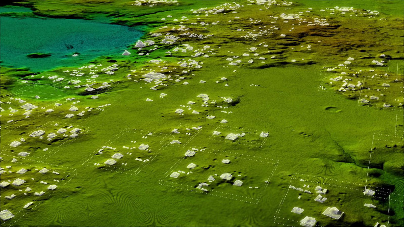
The project mapped more than 2,100 square kilometers of the Maya Biosphere Reserve, producing the largest LiDAR data set ever obtained for archaeological research.
The results suggest that Central America supported an advanced civilization that was more comparable to sophisticated cultures such as ancient Greece or China than to the scattered and sparsely populated city-states that historians and archaeologists had long suggested.
In addition to hundreds of previously unknown structures, the LiDAR images show raised highways connecting urban centers and quarries. Complex irrigation and terracing systems supported intensive agriculture capable of feeding masses of workers who dramatically reshaped the landscape.
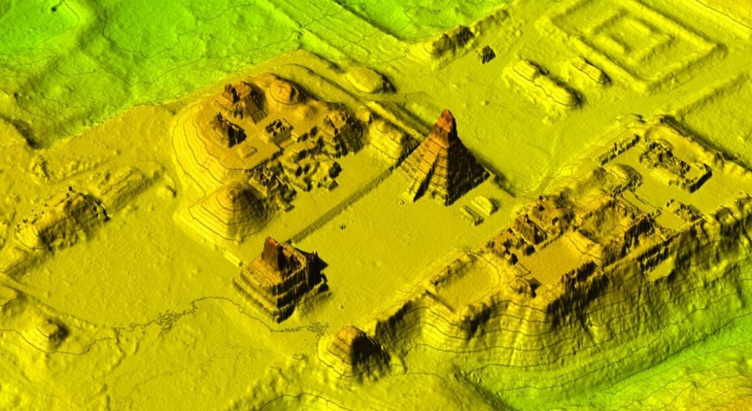
The ancient Maya never used the wheel or beasts of burden, yet “this was a civilization that was literally moving mountains,” said Marcello Canuto, a Tulane University archaeologist.
Virtually all the Mayan cities were connected by causeways wide enough to suggest that they were heavily trafficked. These highways were elevated to allow easy passage even during rainy seasons. In a part of the world where there is usually too much or too little precipitation, the flow of water was meticulously planned and controlled via canals, dikes, and reservoirs.
The survey is the first phase of the PACUNAM LiDAR Initiative, a three-year project that will eventually map more than 5,000 square miles (14,000 square kilometers) of Guatemala’s lowlands, part of a pre-Columbian settlement system that extended north to the Gulf of Mexico.